

From the window of our spare room, we can look to the west and see the rising sun highlighting the peaks standing guard over June Lake. We are in the period called the “shoulder season” by the local businesses – the time between summer fishing and winter skiing. The weather has been mild, an Indian summer with warm days and above-freezing nights. In past years, storms have brought significant snow by now, but this year it is a bit delayed. That is fine by us, since it has provided the opportunity to explore our surroundings and climb those sun-touched peaks outside our window.
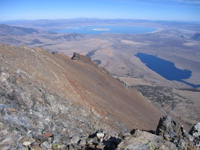
In the winter, we have often looked towards Mt Wood (12,657’) from the June Mtn Ski Area. Its east flank gets covered with what seems an endless expanse of snow, smooth and uninterrupted by cliffs or boulders. In its current un-blanketed state, it is multihued in grays and reds. To reach the top would be too long for day hike, so packed our backpacks with our warmest sleeping bags for an overnight excursion. We camped near Alger Lakes (10,600’). The sun sets by 6:00 pm, so following dinner we were snug in our tent doing crossword puzzles until it was time to sleep. The next morning we packed a lunch and hiked to Koip Peak Pass, then cross-country along the ridge to the summit of Mt Wood. Along the ridge is Parker Peak (12,850’), higher than Mt Wood, but not positioned as well for views. The top photo was taken from our lunch spot on the top of Mt Wood, looking north with Grant Lake on the right and Mono Lake in distance.
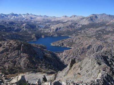
Our next goal, a few days later, was Carson Peak (10,909’). This massive chunk of rock is a prominent landmark visible for just about anywhere in the canyon where June Lake resides. It was a long day hike from the Rush Creek trailhead, 15 miles roundtrip. We waited until 9 am to get started, since our thermometer read 27 degrees when we rolled out of bed. By the time we reached the summit, it had warmed up significantly, with hardly a breath of wind. The views in all directions were outstanding, as you can see from this video. The second photo is looking west into the Ansel Adams Wilderness and towards Yosemite National Park. The reservoir in the foreground is Gem Lake, with Waugh Lake in the distance. The concrete dam was built in 1917, an engineering marvel in its time. Flows from Waugh Lake, Gem Lake, and Agnew Lake still produce electricity used by many of the communities in and around June Lake.
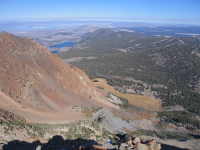
The last peak in the series was San Joaquin Mtn (11,600’). Our hike to this peak started from our front door, where we took the trail to Yost Meadow. We then hiked cross-country up the steep gully to the peak’s east shoulder and eventually to the summit. The view was somewhat obscured by smoke from a fire burning to the south, somewhere in the Kings Canyon area. With binoculars we could see the plumes rising from the bottom of the canyon. We could also see Mammoth Mountain Ski Area, with a dusting of snow from the storm a couple of weeks ago, as well as a wide, white band down the middle of their main run where man-made snow has been spread in anticipation of opening day on November 9th. The third photo is looking northeast – the ski runs of June Mtn Ski Area cut through the forest are visible in the upper right portion of the image. The town of June Lake, as well as June Lake and half of Gull Lake are towards the upper left of the photo. The steep, multi-colored metamorphic rocks in the foreground comprise what is called “The Negatives”. This is a popular backcountry ski run, which John has on his list of future descents – I would consider it under perfect conditions.
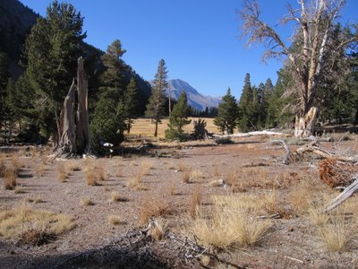
The bottom photo is Yost Meadow, brown in the late-season dryness. The pyramid-shaped Mt Dana with a streak of snow can be seen in the distance. An idyllic place for a rest on our way home.


0 comments:
Post a Comment