Thursday, February 10, 2011

Rangiora, NZ: A Love Story

I am afraid my husband's heart belongs to another.  It is not surprising -- she can be really smooth, with a natural style and impeccable taste.  Apparently this passion has been going on for years, long before we were married, when John was just a young pup in his twenties.  They have been meeting at lunch nearly every day since then, an afternoon delight one could say.

When they first met, she only hung out in one place.  But now she can be found at stores we go to all the time.  When we came here to New Zealand, he took up with cheaper substitutes from Australia and China.  But they lacked the purity and quality of his first love from home.

That is until we discovered Bin Inn, and the spin-off SimpliFood.  She could be found there.  So began his obsession, to find the list of stores in this small country, get his fill at each one to hold him over until the next encounter.  No longer was our traveling driven by finding natural wonders.  No, he was always trying to get to her. 

This jealousy is enough to drive me nuts.  The only explanation I have is like my mother always said, that a way to man's heart is through his stomach.


The last liason was here, in Rangiora.

She has a corner in this store, between buckets and canisters full of bulk foods.


She tries to disguise herself by getting near others with different perfumes.

Sure, Bin Inn has other temptations not found so easily in the USA.

Caught in the act!

Tuesday, February 1, 2011

Aoraki Mount Cook, NZ: Stunned

We are stunned by the kindness of strangers.

Lee and Frank met us for five minutes in Nelson two months ago and invited us to their home when we reached Twizel. So we contacted them, and they offered us so much. Wine and food, a little house all to ourselves, and a vehicle for us use to drive to Mt Cook National Park.
 
We are stunned by the scale of the landscape.

Frank drove us around to see his land and subdivisions, 5000 acres in all, and to see where the Plains of Rohan scene was filmed, and to see the canals and power generators of the Waitaki Valley Hydroelectric Scheme.

We are stunned by the majesty of Mt Cook.

The weather forecast was for a rare clear day, and only one of them.  So instead of using that day to cycle to the village of Aoraki Mt Cook, we took the borrowed truck, loaded with camping gear, for an overnighter at the base of this great mountain.  It is the highest peak in New Zealand.  It is visible from the West Coast, although it was shrouded in clouds when we looked for it from that side of the island.  But on this day, we were so close we were speechless.

Thank you, Lee and Frank, for making this memory.

John mastered left-hand shifting to get us to the shore of Lake Pukaki for the morning view of Mt Cook.

The glacial outwash plain downstream of Mt Cook feeds Lake Pukaki.

Mt Cook, 3,754 meters (12,316 feet)

We sat for a couple of hours sitting and staring at these glaciers from Kea Point. 

Wind clouds, like the Sierra Wave that forms in the lee of the crest of the Sierra Nevada at home.

We spent the afternoon hiking up Hooker Valley.  There were two swingbridges crossing the glacial stream.

The Hooker Glacier terminates into Hooker Lake at the end of the trail.  Strong winds of an approaching storm kicks up dust on the left side slopes.


It had been raining for several hours when we left the village, but we drove out of it 20 kilometers down the road.  Looking back, we could see it was still raining at the crest.

Sunday, January 30, 2011

Omarama, NZ: Two Days, Two Passes

We heard  about the Crown Range Road from other bike tourists.  It is is the most direct route between Wanaka and Queenstown.  In the year 2000 the last dirt stretch was paved, and now claims to be the highest sealed road in New Zealand.  It is a popular route, for campervans and bicycles alike, and the morning we conquered it, there were plenty of both.

It was a quiet, drizzling Sunday morning when we left Arrowtown.  Campervans zoomed by from both directions, but neither the vehicles or the increasing moisture could slow us down any more than the 5 km/hr we were going.  John always pulls ahead on hills, and I saw him stopped at the top of the final grade.  Also at the top was a bus with a trailer with bike racks with the logo for Pacific Cycle Tours.  As we were desperately putting on all our layers to trap some heat before the wind sucked it out of us, cyclists on ultra-light racing bikes began to come up that final hill.  The driver of the bus was hooting and hollering for each one of them and taking their picture.  They would reach the top, and then dive into the bus.  All I could presume is that hot tea and warm clothes, and even perhaps a personal masseuse, awaited them.  No cheers for us, but then I guess we didn't pay for them.

View from the top looking south from where we ascended.  It was a cold night, and there was a light snow covering on the peaks across the valley.

The sun came out and the wind was at our backs as we cycled down the other side towards Wanaka.  It was 40 kilometers of downhill bliss -- we just had to coast and take in the scenery. 

The Crown Range Road goes through the former gold mining region of Cardrona, but now famous for its ski fields.  The racing cycles passed us at breakneck speed, collecting as group at the historic Cardrona Hotel.   As much we wanted to also stop of a hot coffee and peek inside, we decided not to mingle.  So we had a picnic in the park down the street and drank up the sunshine instead. 

They passed us one more time, but a sub-group slowed down to chat.  One woman said how much she admired what we were doing.  And when we learned that this group was on a trip that took them from Bluff to Picton, from the south tip to the north tip of the South Island, in 12 days, each of them cycling 140 kilometers a day. Learning this, our admiration was mutual.

Following the high of the Crown Range Road, one of our best days yet, was the ascent of Lindis Pass.  On this day the skies were gray and overcast, there a constant flow of cars and trucks passing us,a strong headwind, and a steady uphill.  There were no stores, no services, nothing but a few sheep ranches and endless fences to break the view of the dry landscape.  And nobody cheering us on, just a group of guys in a car at the top all getting out to pee.

Only 105 meters lower than the Cardrona Pass, the tough conditions made it feel like it should have been higher!

At the top, hoping we can find a campsite before it starts raining.
It was too far to get to a holiday park that night, so we descended, stopping periodically to look at potential campsites.  We finally reached a rest stop, and since it did not explicitly say "No Camping", we took advantage of the protection from rain and wind in the canopy of trees.  Dry clothes and a hot meal and we were renewed.  Only on car stopped all evening, and the driver stopped by to chat.  He was an Asian currently picking fruit on a work visa, but had just finished up 1 1/2 months of bike touring in Australia.  He gave us a box of cookies, a gift of admiration, which we accepted gladly.

Our campsite at the north side of Lindis Pass.
Although it rained a bit overnight, it cleared out the next morning before we were underway.  And like almost every day we have been in New Zealand, the weather today was nothing like the day before.  Strong winds blew us to Omarama, puffy clouds and the big blue sky of the Mackenzie District all around us.  No passes to cross today!

Bands of clouds pass by as the storm from the previous night clears.

Our first view of Mt Cook, the highest point in New Zealand.

Thursday, January 27, 2011

Glenorchy, NZ: If You Don't Like the Weather, Just Wait a Day

Queenstown is adventure central for New Zealand.  From here there is paragliding, river rafting, bungy jumping, skiing, tramping, kayaaking, etc.  It is a compact town built on the northern shore of glacial Lake Wakatipu, a long sinuous body of water that looks like a giant scour mark on the map.  We arrived by midday after our steamship ride across the lake, and there were tourists of all variety milling about the streets.  We had no intention of staying here, and after obtaining some artisan bread and other groceries, we headed along the north shore towards the head of the lake.  Once again, our quest to see the end of the road shadowed the warning signs.

We were told this road to Glenorchy had some ups and downs and steep climbs.  Oh, hills are no problem for us -- we did the Coromandel!  And then there were the norwesterly winds, blowing into our face.  Oh, they don't seem too bad, and we can get protection from the trees alongside the road!  And then there was the mist shrouding the peaks -- it wasn't forecast to rain till later, right?

So 24 kilometers down the road and two hours later, John stopped and turned to me and said he was questioning our decision to ride this road.  It was like riding in a moist wind tunnel on a treadmill set to maximum resistance.  We pondered our options, which included turning back and going up the many downhills we had just finished.  A couple of day cyclists came by from the opposite direction, and we had a 15 second conversation that verified that it was not raining at the end of the lake, and the terrain flattens out in "5 to 10 kilometers".  We didn't have a chance to ask about the wind.

So we pushed forward, rolling down a long, steep incline that we both knew was the point of no return.  And for the next 26 kilometers and three hours we dug deep into our reserves and pushed the uphills, and due to the wind, the downhills and flats, too.  It was a wild ride, with clouds moving around the peaks and light constantly changing the hue of the water.  We had a final rest just a kilometer out of the village of Glenorchy, at a broad opening of a road with a fairly impressive fence and stone sign.  A fancy SUV came out of the road, and the driver rolled down the window.  For a moment I thought he might invite us to stay at his fancy house.  But he asked if we were lost, and we replied, no, just tired and resting.  He chortled, and said it was not far to Glenorchy, wished us luck, rolled up the window, and drove off.  We later learned that the Blanket Bay resort rents rooms for over $1400 a night, so fat chance of us getting an invite to stay there!


It was a kaleidescope of colors and clouds on the cycle in.
We were beat, and slept like the dead that night.  We had planned to stay a day to explore the surroundings, but shortly after breakfast it started to rain.  It rained all morning, it rained when we walked to the local cafe for lunch, it rained the two hours we sat in the local library, it rained as we walked back.  The campground was one of few comforts, and we hung out in the kitchen in the late afternoon.  We ended up talking for a good while with Karen and Gary, early retirees and like-minded travelers from Australia.  The skies cleared, our laundry dried, we were well-rested, and all was well with the world again.

Water hazards formed all around us as the rain poured down all day.
The next day was fantastic -- not a breath of wind, blue skies, and stellar views of the high country that was obscured on our way in.  And the dread of traveling back on that road that was so tortuous just the other day proved to be no problem without a headwind.  Easily, our best day cycling in New Zealand.


All is forgiven when the sun is shining!

Looking northwest towards the peaks surrounding Glenorchy.  The turquoise color of the glacial waters of Lake Wakapitu was stunning in the morning light.

Healthy and happy!

Monday, January 24, 2011

Mavora Lakes, NZ: Gravel Road to Heaven

We met a couple of bike tourists from Sweden almost two months ago.  The conversation upon meeting others of our species generally includes: where are you going, where have you been, how long have you been in New Zealand, and if they are traveling in the opposite direction, where is the nearest grocery store.  This couple mentioned that they did a particular route, and it was the best thing they had experienced in New Zealand -- the gravel road that passes by Mavora Lakes north of Te Anau.

Since then we have done a fair amount of research online and questioning locals about if our skinny tires, drop handlebars, and loaded panniers could handle it.  No red flags came up, the weather forecast showed several fine days, so we decided to go for it.

An ambitious cyclist would do it in one day, most others two, and we stretched it out to three.  Our first day traveling north was on a quiet Sunday morning.  The gravel road was very well packed and with a steady, almost imperceptible, uphill grade.  By early afternoon we had covered the 70 kilometers from Te Anau, including the 38 kilometers of gravel.  The hardest thing we had to do the rest of the day was select a campsite.

The road passed large pastures of grazing sheep for many kilometers, making the landscape along this gravel route not much different from many other roads in New Zealand.

The road made a steady climb towards the mountains where the glacial Mavora Lakes are located.

Look familiar?  The outlet of South Mavora Lake was the film location for Lord of the Rings, where the Fellowship leaves Lothlorien on the Anduin River.

Mavora Lakes is a Dept of Conservation recreation area, with a few designated campsites with tables, water, and toilets.

Fine weather offered beautiful views looking towards North Mavora Lake from the shore near our campsite.
The next day was the real highlight of the trip.  Leaving the Lakes and the DOC controlled area, we entered land that was privatively owned, with a public road running through it.  A stern sign stating no camping allowed was posted at the boundary.  Here range cattle wandered the grasslands in a glacial-carved valley.  The cattle were a bit skittish as we cycled by, and an extra ring or two with our bell was necessary to keep them moving away, as well as to confuse the big bulls that lumbered towards us.


Big, sunny skies.

The valley began to narrow as we moved north, with mountains hemming us in on either side.

At the point where there was no more valley, we dropped down into the channel of the Von River.  This view is looking south from where we came.   

A steep couple of kilometers dropped us into the narrow Von River valley.
It was early afternoon, a day of full sun a little wind, and warmer than we had experienced in a while.  After 45 kilometers, we rested in the shade of trees next to an old stone house at a stock station.  The longer we lingered, the more we realized the stone patio would make a nice campsite.  We waited to set up our tent, instead leaving our bikes fully packed and just sitting down to cook dinner, out of sight of the road.  We had not seen a car for hours, and John wandered out in the open to take a photo.  Just then a fast-moving ute came down the road, and spying a figure, pulled in to investigate.  We were informed by a polite but stern gentleman that no camping was allowed and that we really shouldn't be there without permission of the owner, which we did not have.  Obviously, being on bikes, we could not leave the restricted area that night, so he said we could stay, just leave the place clean.  We said many thank-yous and apologies, and set up our tent for the night, a bit chagrined.

A lovely, illegal campsite.
The following day brought a change in weather, and we had to bundle up to stay warm under cool, overcast skies.  Today we would cycle the remaining 20 kilometers to catch a steamship that would ferry us across Lake Wakatipu, transporting us from this open land to the bustle of Queenstown.

And if we get a chance to tell another bike tourist about the trip, we might also just have to say it was one of the best experiences of our journey.

Cycling the last bit of gravel to Walter Peak Station.

The TSS Earnslaw, a vintage steamship operating on the lake since 1912.  Before roads were constructed to Walter Peak Station, sheep were transported on this boat to and from Queenstown.

The ship is powered by coal shoveled into the furnace in the engine room below the deck.

Last views of Walter Peak Station from the deck.

Friday, January 21, 2011

Te Anau, NZ: A Fiordlands Journey

Te Anau is a town built for tourism. Not big, but full of accommodation options, eating establishments, and booking agencies for access to the Fiordlands and the premier tramping routes in the area.  Here we were on the edge of yet another very unique section of this small country -- the Fiordlands -- virtually inaccessible except by air or boat or by a few trails that thread their way between huts.  Carved by glaciers that etched deep canyons out of the granitic rock, it is a terrain more familiar in Norway, and a destination for just about every tourist visiting New Zealand.  Including us.

Most tourists choose to take a couple hour boat cruise through Milford Sound.  The boat originates from the dock at the end of the dead-end Milford Road.  Getting to the dock requires going over a pass, through a 1200 meter plus long tunnel, on a narrow road with a constant flow of tour buses passing, through an area that gets 20 feet (feet!) of rain a year.  And then coming back again.  What would you do?  The last cyclists we met rode in and took the bus back out.  We chose to take a tour bus/cruise combo for a one-day trip to save our bodies to continue our journey beyond Te Anau.

Our bus and fellow passengers for the day.
We selected the least expensive package, but ended up with the best tour guide.  Simon, a former conservation worker, was well-versed in all things about the natural history -- the plants, the birds, the geology.  He traded in the life of constant travel and low wages to provide for his family, and live a simple life on the shores of Lake Te Anau in a cabin without electricity.  John sat up in the front seat of the bus next to him, and chatted with him most of the day.  Not only about what we would see out the window, but about trails and tramps and routes to explore in the region.  The drive took longer than the cruise, and depending on the group's interest, Simon would make frequent stops at vista points and natural spots.  He showed us wild black orchids, one of only four growing in the valley on the way to Milford Sound.

Mist was lifting and rising all day on the surrounding peaks.

Aptly named -- Mirror Lakes.

Rushing water emanating from the glaciers high in the mountains, with the distinctive turquoise tint from fine glacial silt.

If I were a true German, I would jump into this icy pool naked.

One of the reasons we did not bike the Milford Road -- Homer Tunnel.

Meet one happy boy -- he has been quaking with anticipation of seeing Milford Sound since our journey was just a concept.

The waters were like black glass.

Waterfalls cascade from a hanging glacial valleys.

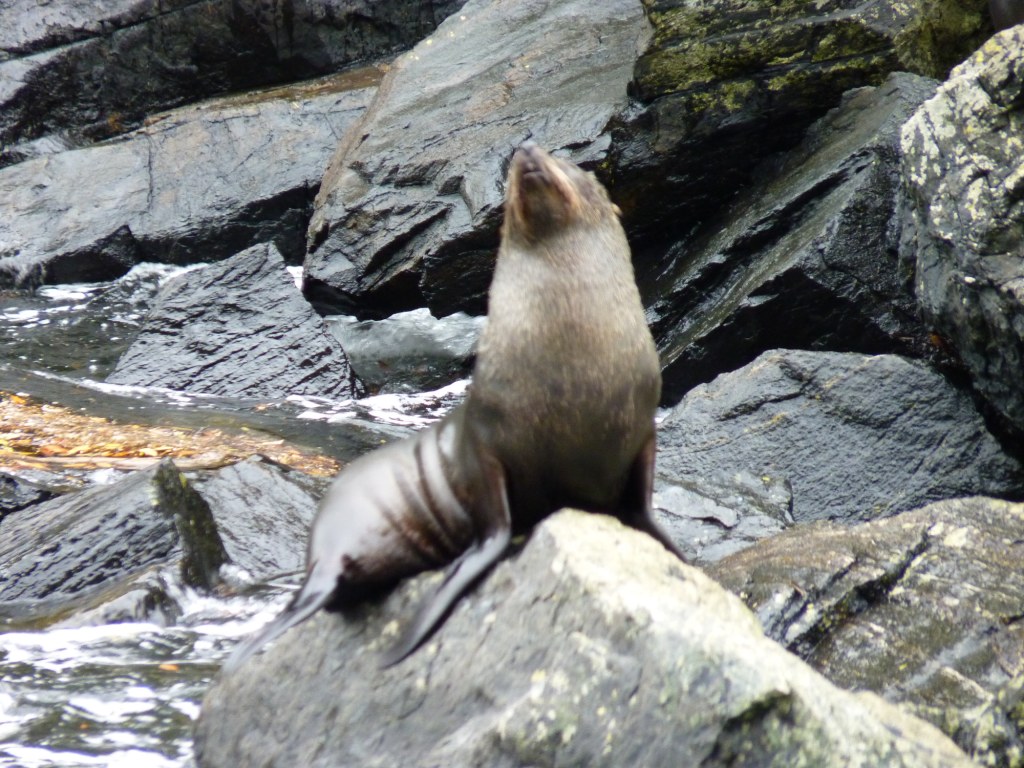
Seals greet us from the shore.

The boat passes under a waterfall.  Only a couple folks in our group frolicked in the cascade.

Water, water, everywhere.

Twenty feet of rain per year = lush rain forest.

Glacier view.

A Kea, the native, rare everywhere except in tourist centers where they might get a handout.

A parting view at the end of a most spectacular day.

Translate

Copyright

All original text and photos are copyrighted Doris Reilly © 2006-2023. No part of the content or the blog may be reproduced without prior written permission.
Powered by Blogger.

Contact Form

Name

Email *

Message *