Saturday, July 22, 2006

Friends and Gems


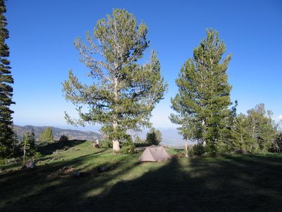
What kind of friends would drive all the way from California to Montana to camp with us? Well, they didn’t really come all this way to just see us. Sapphires, garnets, and family visits were their other motives. But we like to think Virgil and Gwen came all this way just to see us.

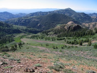
We met in the small town of Phillipsburg, an old mining town that has found a second life as the county seat for ranching and tourism. We camped south of town, in the coolness of the higher elevation at Cable Campground near Georgetown Lake. We enjoyed catching up, the talk flowing as freely as the wine. We parted the next day – us off to reunite with my parents outside Glacier National Park, and Gwen and Virgil back to the sapphire mines.

It was fun seeing you, Gwen and Virgil!

Wednesday, July 19, 2006

I will not forget...


The day started out spectacular. After the clouds and rain of the previous day, the morning was clear and bright. Our goal was Trapper Peak. We saw this one from the vantage of Medicine Point Lookout – it was a high peak, and according to the map there was an established trail to the summit. It was a seven mile steep dirt road from the highway, and we were hiking by 9 am.

John realized he forgot his wind jacket and pants after the first 10 minutes on the trail. Dilemma – risk going to the peak without or go back and get them? The weather could change quickly, and it was bound to be breezy on the peak, so he decided to go back and get them. Let me point out the trail to the peak was steep – about 3,700 feet elevation gain in five miles – and the path from the trailhead parking lot was straight up. But John, frustrated with his forgetfulness, ran down the trail to retrieve his gear, and hustled back up. By the time he got back to where I was waiting, perched on a rock in the sun, he was sweating and breathing heavily.

We continued on. The last portion was cross-country over boulders with only a few cairns to mark the route. We did not expect to see anyone – it was the middle of the week, and we have become accustomed to the solitary remoteness of our hikes. To our surprise we met a man on his way down, a biology teacher from Helena, looking for the elusive Parry's Primrose, which only grows above 10,000 feet. Trapper Peak was the northernmost occurrence of this flower. He spoke with a Swedish lilt, and described to us the purple flower so we also could search it out.

We made it to the summit for lunch and the customary ritual of taking pictures of the entire 360 degree view. The view was not what we expected – our previous day’s hike to the south was lower in elevation, deep in the forest, and our views were slightly obscured by the inclement weather. From Trapper Peak, however, we saw the Bitterroot Mountains in their full glory – massive granitic rocks, steep cirques polished by glaciers. The range has a definite grain, with deep, straight canyons running east-west, stacked in series from south to north. Another couple, locals from Missoula, reached the summit as we were preparing to head down. In addition to giving us hints on camping spots and health food stores, they told us Trapper Peak was also the highest peak in the range at 10,157 feet. An accidental peak of significance for us! The picture of the day is us at the summit celebrating this fact.

So, John’s penance for forgetting his wind gear was sore muscles from running down a steep trail. My penance will be to write 100 times “I will not forget my boots at the trailhead”. I did not notice this fact until the day after our Trapper Peak hike that my boots were not in the car. I did not remember putting them in after changing into sandals at the end of the hike, so the best guess was they were still at the trailhead. So we packed up camp early and made a detour up and back on that dusty, rough dirt road to retrieve them. Fortunately, nobody with a women’s size 10 foot noticed them, and the rodents stayed clear of the odorous wonders. When we pulled up to the spot where we parked the day before, there they were – looking perky like they were ready for another hike.

So I am going to get started…

I will not forget my boots at the trailhead…I will not forget my boots at the trailhead…I will not forget my boots at the trailhead…I will not forget my boots at the trailhead… I will not forget my boots at the trailhead…I will not forget…

Posted using free wi-fi from the public library in Missoula, Montana.

Friday, July 14, 2006

Megafauna


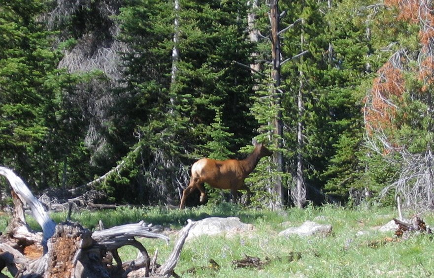
John has a little pocket calendar. Each day he notes where we camped, what we did, and what wildlife we saw. It may include birds which are new to us, but mostly it is the large hoofed animals that get counted and noted. White-tail deer are common, but we get excited when we spot elk. Just yesterday we encountered a band of 11 crossing the road in front of us. We were getting dinner together the other day at our campsite, and Mom exclaims “Look, a moose!”, and sure enough there was one sauntering up the creek, just a hundred feet away. It gave us barely a glance.

The best so far, however, was the band of seven Mountain Sheep we spooked on a ridge hike near Challis Lakes in Idaho. We were hiking cross-country about mid-morning. John was leading, and he turns to me gesturing for me to come quickly. There they were, maybe 30 feet away, and when they sensed our presence they moved as a unit to the next ridge over. We could tell that was not where they wanted to be. We stood still, and when they decided that we were not a threat, they moved across to a rock promontory where they were hidden from our view. We had enough time to get it on video – click here to see it.

Posted using free wi-fi from the public library in Missoula, Montana.

Tour de Lookouts


It wasn’t intentional, but our last several outings have been to lookout towers. We did not realize it, but lookouts in the forests of Idaho, and much of the Northwest, are regularly spaced so they are visible from each other, and sit atop many of the highest points. John’s philosophy is, if you want a guaranteed 360° view, why not seek out trails to lookouts? We have come to not only appreciate the views, but also the history of these structures.

Our first one was on Lookout Mountain (9954’) in the region between the Sawtooth and White Cloud Ranges. The name was a bit obvious, but it piqued our interest. This tower was typical of many. Built in the 1930’s but has not been used since the early 1970’s. This lookout was only accessible via a 7-mile hiking trail. Many lookouts from this period were built by labor of the Civilian Conservation Corps (CCC), the work program during the Depression. Designated a National Historical Site, it must be preserved in its original state, but there are often little funds to do this for these remote sites. The lookout is one room, no larger than about 16’x16’, with a walkway all around. The building has large glass windows on all sides, but they were shuttered up. The door was unlocked, and we could look inside. A register for visitors had entries from folks who stayed the night, commenting on the brilliance of the sunrise and sunset.

As we traveled north, we noticed more and more lookouts on the map. We drove to the Pinyon Peak Lookout (9942’), deep in the Frank Church-River of No Return Wilderness. This one was manned by an older gentleman and his equally gentle dog. It was a rainy day, and our host talked of spotting 15 lightning strikes the previous evening. This lookout was the oldest manned lookout in the U.S., dating from 1930, with the log cabin construction of the era. From this peak we could see Lookout Mountain, where we stood just a few days before. The road to get to this lookout transects the wilderness area, often only wide enough for a single vehicle, and following ridges that drop off steeply to either side. We made a grand loop from our camp near the historic mining town of Custer to Stanley on this road. We passed by the former lookout on Sheep Mountain (9192’), with only a concrete foundation and flagpole remaining at the site.

The following day was still overcast, but less threatening. We hiked from our camp to Custer Lookout (9753’). This was another unmanned lookout, but there was plenty of gear inside – cots, kitchen utensils, wood-burning stove, tools. It looked like you could move in tomorrow and start working. Inside was a register, but also paperwork from the early 1970’s, including a fireman’s handbook and a log of a fire observation from 1972.

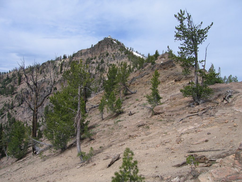
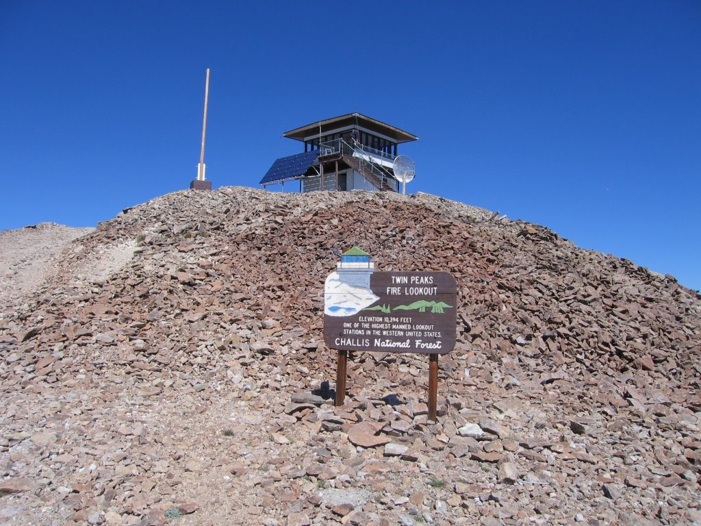
We traveled further north and camped west of Challis, Idaho. Here we hiked to our most spectacular lookout yet on Twin Peaks (10340’). This is the highest manned lookout currently in the conterminous U.S. Our host here was a young man about 19 years old. He has spent nearly every summer of his life on lookouts with his mother, who worked as a lookout operator, and two younger siblings. This was his first season as a paid employee with a lookout of his own. His mother was working another lookout 100 miles to the north. He welcomed the company, but had his computer chess game and a Fender Telcaster (no electricity, therefore no amp) to occupy his solitary time. We had a blue sky day, the multicolored volcanic rocks of the Twin Peaks caldera all around us. We couldn’t stop looking at the landscape.

Our most recent lookout summit was Medicine Point (8409’) in the Bitterroot Range of Montana. The Forest Service makes some lookouts available for overnight rentals, and this was one of those. For $30 a night you get a propane stove, sleeping pad, forest green gingham tablecloths, and a panoramic view. No one was renting this lookout when we visited, but the shutters were all up and we could look inside. Very cozy.

We have since found the book called “Fire Lookouts of the Northwest” by Ray Kresek in the local libraries where we get Internet access. This book lists all the lookouts in Idaho, Montana, Washington and Oregon, when they were built, elevation, location, and status. But best of all are the stories of the culture of these lookouts and the characters that worked these lookouts in their heyday. We copied a few pages for the areas we plan to travel through, and it has become a bit of a game to find them on the map. We may check off a few more before this trip is over…

The pictures from top to bottom are:

Lookout Mountain, with the Sawtooths in the background,

Pinyon Peak with John discussing geographic points with the host – notice the shutters and rough-hewn wood construction,

Concrete pillars marking the former site of the Sheep Mountain Lookout,

Custer Lookout from a distance,

Twin Peaks Lookout, with an array of solar panels for operation of the radio relay station.

Interior of the Medicine Point Lookout.

Posted using free wi-fi from the public library in Missoula, Montana.

Friday, July 7, 2006

Hiding in the Sawtooths


When the voice of experience talks, it makes sense to listen. When my parents say, we need to find a place to hide over the Fourth of July weekend, they were right. Mom and Dad have been traveling for months at a time for the last 23 summers. As the holiday weekend approached they said we need to find a campsite early, and plan on staying there until the vacationers leave. So we found refuge in the Sawtooth National Recreation Area, a range of mountains in central Idaho.

We found a campsite next to a stream in an area designated as dispersed camping – there are no facilities like toilets, tables, or faucets, but there are informal campfire rings and flat places to pull off and hunker down. Nestled among the trees, we were ready. By Friday they were coming in – SUV’s with racks of bikes, RV’s pulling trailers with quad cycles – filling up the campgrounds and the dispersed areas. Looking at some of the campsites from a distance, it is like a yard sale -- picnic tables invisible under piles of gear, ice chests, and bags of chips and sodas. John and I spent the weekend doing day hikes – fortunately you can get away from most everyone a couple of miles from the trailhead. One of hikes was to Sawtooth Lake, the featured photo. Only five miles from the parking lot, it offered views of the rugged granite peaks characteristic of the range, and cobalt blue lakes with remnants of winter snow still on the lake surface.

The days are long this time of year this far north – dusk is just beginning to settle in at 10 pm. It must be some kind of law that a campfire is compulsory when camping -- the group that set up camped a couple of hundred yards upstream from us built a bonfire just as we went to bed. I was so tired from our hike that I fell into a deep sleep once horizontal. John, however, was awake long enough to hear thumping music, loud laughter, and to smell the smoke from the fire. This discourtesy gets him so worked up, he focuses on the sounds and can’t sleep. He was a bit bleary the next morning. Mom and Dad, insulated from all noise in their cozy van, slept through it like me. By Monday afternoon the legions of weekend warriors were heading home, and we found peace once again.

A final note – yes, mosquito season is almost in full bloom. Right now they swarm but are easily swatted before getting a chance to draw blood. Evenings, right around dinnertime, seems to be the worst. Sweet people like John and my mother seem to attract them the most. That makes Dad and me a couple of sourpusses, I guess.

Tuesday, June 27, 2006

Jarbidge Crossings


Note: This post includes a link to a video sharing site -- you may need to download the Adobe Flash player to view it. -- DR

If it is solitude, isolation, and landscapes of great beauty you seek, then the Jarbidge Wilderness is the place to go. Much of Nevada is in general sparsely populated and remote, but this area in the northeastern corner of the state is especially so. On the advice of the Forest Service office in Wells, we headed to the Slide Creek trailhead, 20 miles off a dirt road, and even the last of the paved road was a couple hours from any settlement. Our goal was another three day backpack trip to explore the wilderness.

Our first day was one of stream crossings. As with much of the places we have been so far this year in the West, the exceptional snows from the winter stayed late, but were melting fast and swelling the creeks. Most stream crossing have an array of rocks or logs that one can use to get across without taking off the boots. The use of hiking poles offsets the compromised balance from a carrying a full pack in these Twister-like situations. For larger streams, taking off the boots may be necessary but never welcome for a couple of reasons – the water can be icy, toe-numbing cold, and it takes a good 15 to 20 minutes to do the full boot removal, cross, dry feet, boots on sequence. In the past situations that required boot removal, we would cross in bare feet, feeling our way across slippery rocks. I can remember one particular hairy crossing with our friend Gwen in Convict Creek in the Sierra – besides being deep and swift, the crossing was particularly wide, and by the time we got to the other side we were in pain and near tears. We now carry a pair of “Aqua Socks” – beach sandals with a rubber sole and mesh material top. John and I have near the same foot size so we only carry one pair. I sewed a nylon bag for the shoes. Now one of us will cross first while tethered to a 50-foot cord. After crossing the socks go in the bag, tied to the cord, and thrown to the person on the other side.

The loop trip John scoped out followed Slide Creek – we dropped down in elevation for about 6 miles before hitting the East Fork of Jarbidge Creek. The plan was to cross and head up a canyon to Emerald Lake, but when we came to that crossing, we hesitated. We watched the creek for a while – it was flowing fast and was at least three feet deep. A loss of footing could send us bobbing like an apple at a Halloween party. Fortunately we had an alternate route, and we bypassed the crossing and continued up canyon. We encountered only one other significant stream crossing, across two spindly tree trunks tied together with appeared to be kite string which offered a challenge in poise and balance. See John cross a stream from this link.

The area is primarily volcanic rocks that form benches and hoodoos. The terrain is steep with prominent avalanche slide paths on the slopes. These are desert mountains, but in the creek bottoms it is lush, with plentiful wildflowers, cottonwoods, skunk cabbage, and grasses. The higher slopes are covered with sagebrush, but from a distance it is a continuous green that offsets the red of the rocks, occasionally punctuated by lingering snow drifts.

As we hiked the trail, we saw evidence of other hikers – an occasional candy wrapper, some flattened vegetation, boot prints in the mud. As we neared our final stream crossing before camp, gathered at the base of a tree was a crowd – 17 Boy Sprouts and three of their leaders. They were as surprised to see us as we were to see them. They hailed from Twin Falls, Idaho and ranged in age from 12 to 18 years old. Out for three days, they had one more night before heading home. One leader commented he was ready for a hamburger. We enjoyed chatting with them, but were relieved to hear they were hiking a few more miles before setting up camp – the feeling of solitude is a bit dampened by that many pubescent boys so close by.

The next day was one of great scenery but physical challenge. Already tired from the previous day, our loop took us another 1,600 feet up in elevation to a point where the trail was obscured by snow. An inconvenient place, since we had to cross over a ridge that was nearly vertical in places. We ended up going cross-country up to a saddle that looked like where the trail should terminate – with John’s superior navigation skills, it was the right place. The rest of the day was mostly uphill. When we finally came to a high point with a panoramic view of the valleys to the east, we made camp. I was beat – we set up the tent and washed up. I could not resist lying down on the lofted down bags, with the afternoon breeze wafting through the tent and, taking a nap – I felt like an angel bedded in a cloud. (The second picture is from this campsite -- if you look real close you can see me in the picture.)

We completed our loop the next day, going mostly horizontal on a very infrequently traveled stretch. The trail was almost indiscernible in places, overgrown with brush and with many trees blown down across the trail. Funding for maintenance activities in these remote areas have not been available for decades, and probably won’t be in the future, so our laying of treads helped keep them from disappearing in some small way.

Tuesday, June 20, 2006

Peaks and Old Pines


Note: My apologies for the relative dryness of this post – I have been occupied with reading the “Da Vinci Code” obsessively – Mom, Dad, and John each read it with equally reclusive behavior, and I was the next in line. Enjoy the photos! --DR

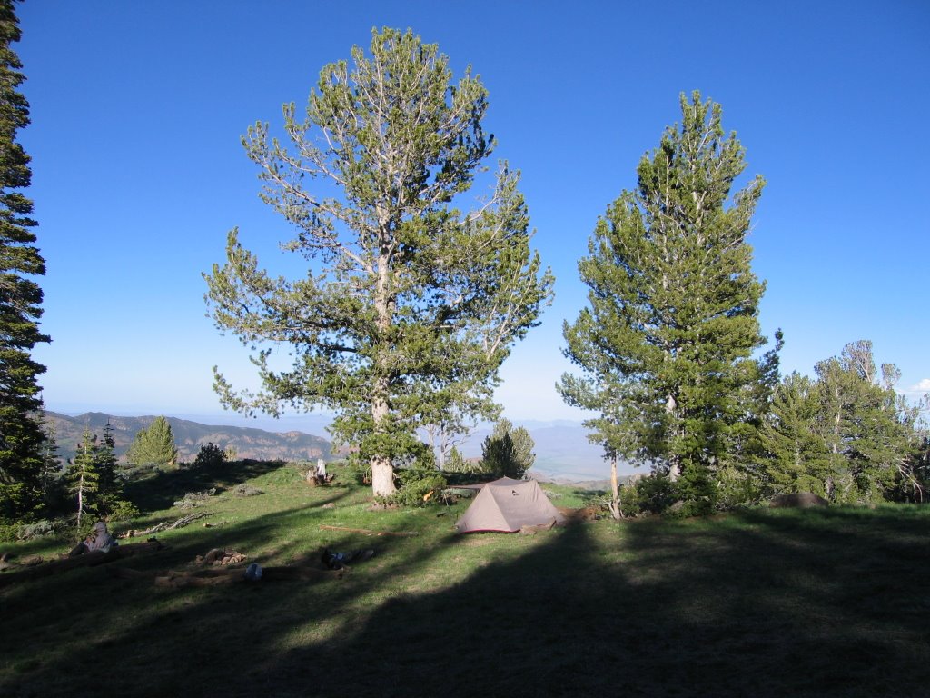
We spent three days in Great Basin National Park challenging our uphill muscles. We started with an overnight backpack trip to Baker Lake (top photo). We reached the lake by noon, and after a quick lunch we climbed cross-country to Baker Peak. From this peak we could look across a very large cirque to Wheeler Peak. With binoculars we could see other hikers at the summit, and even make out that one of them wore a red parka. The air was clear, and we could make out the snow-covered peaks of the Wasatch Mountains outside of Salt Lake City.

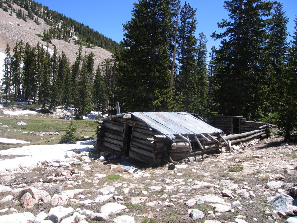
This was a loop trip – one of our unwritten rules is never to retrace your route if possible. We continued the next morning by Johnson Lake, where the remnants of a tungsten mining operation (circa 1913), including aerial cables and miners cabins (second photo) occupied the lake basin.

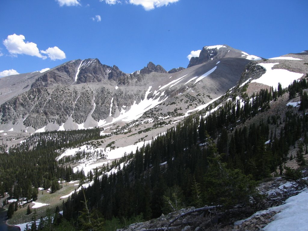
Day 3 was a hike to the top of Wheeler Peak, the second-highest peak in Nevada at 13,063’ (third photo). We started early, and despite the howling wind on the ridge approaching the peak, we reached the summit in good time. We watched with binoculars as two other couples meandered across the same ridge, only to turn back. We had the summit to ourselves. We had an unobscured view in all directions, allowing us to see the faint outline of the Ruby Mountains to the north (our next destination).

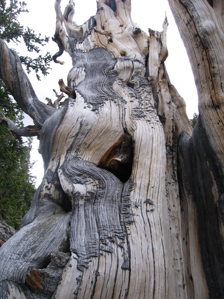
The Park also has three groves of Bristlecone Pines, some of the oldest living organisms on earth. We took the side trip on our descent to one of these groves, feeling insignificantly young next to some of these trees (fourth photo) that are almost 5,000 years old.

Translate

Copyright

All original text and photos are copyrighted Doris Reilly © 2006-2023. No part of the content or the blog may be reproduced without prior written permission.
Powered by Blogger.

Contact Form

Name

Email *

Message *