Monday, November 15, 2010

Featherston, NZ: The Rumataka Incline

On the advice of numerous cyclists and other sage travelers, we avoided New Zealand's Highway 1 as it slices down the southern half of the  North Island.  We heard it would be like cycling down Interstate 5 of California -- lots of trucks, with the New Zealand touch of narrow bridges and minimal shoulders.  So our route went down Highway 2 instead, a route barely traveled by tourists (I counted zero camper vans for three days).  A very rural stretch dominated by dairy farms, we found ourselves in Eketahuna. We spent two nights there, unanticipated, due to misty rain.  It turns out the town is located in a microclimate that traps moisture as it comes over the mountains, and if we had just gone 10 kilometers south over a pass, we would have had sun and warmth.  One quote we heard was we could grow old waiting for the rain to stop in Eketahuna.

As we headed south, we heard over and over about the Rimutaka Grade, about a steep, curvy road with heavy winds, unsafe for cyclists.  But an Internet search of other bike tourists that had past this way confirmed the dangers, we began looking for an alternative.  One was to buy a train ticket and ride over the pass.  But the more intriguing alternative was to follow the trace of the old rail grade, the Rimutka Incline, which has since been converted to a bike and walkway path.

A mandatory stop was at the museum in Featherston where the only remaining Fell engine is housed.  The Rumutaka Incline railway was constructed in 1877, and was the link between the harbour of Wellington and the agricultural valleys over the mountain range to the northeast.  Because the incline had grades of 1 to 13 in some sections, too steep for normal steam engines, it required a special engine design.  Even today rail grades are seldom greater than 1 to 30.  The Fell engine was used continuously until 1955.  The unique design used a third center rail for extra grip on the uphill and braking on the down.  Read all about it here -- it is a fascinating history. 

Oiling the old engine -- it still runs and they fired it up while we were there.

Old photos covered the walls in the museum.  This one shows the turn with constructed fencing in the area named Siberia.  It was added after a train was blown off the tracks due to high winds.

The rail trail was 17 kilometers from end to end, and there was campsites along the way.  So we planned an overnighter and filled up with provisions as we headed to the Incline.

I doubt that steam engines still cross here, but it is a romantic thought.
It was a beautiful sunny day, with puffy clouds on the horizon.  It was only 7 kilometers up to the high point they call the Summit, and that was our destination.  But the first two kilometers of the trail turned out to be just a narrow walking path through the forest along a creek, which we had to push our bikes along the whole way.  So we opted to camp at Cross Creek at the bottom of the grade, and the site of the old railway station.

Crossing the bridge at the end of the trail to Cross Creek station site.


Information posts were situated at points of historical interest all along the path.

Remnants of the old turnstile where standard trains coming up the flat valley were turned around after switching their cargo cars to the Fell engines, which would carry the cars to the Summit station.

Troughs where trains would be serviced -- brakes were replaced after every descent, they wore out so quickly.

We had the Cross Creek campsite to ourselves.  There was a small shelter with benches.
We were full of anticipation of the ascent the next day.  From Cross Creek we would follow the gravel rail bed, and we fully expected the great weather to greet us the next morning.  But some time overnight the winds picked up, so great that they bent our tent nearly flat.  We huddled in the shelter to cook breakfast as gusts of wind howled outside.

We proceeded up the trail.  the grade was steep but rideable, but the 100 km/hr gusts kept us from pedaling.  So we pushed our bikes most of the way up.

The site of the Siberia creek crossing (see previous old photo).  The bridge is gone, but all that remains is the piling.  The drop into and out of the creek bed was so steep we had to take the bikes down one-by-one -- John at the front, and me hanging onto the back so it would not roll down on its own.

Entering the Summit Tunnel -- one of four on the trail.

The Summit Station site -- the top of the steep 1 to 13 grade, and the beginning of the gentler 1 to 40 grade descent for the remaining 11 kilometers.

It's all downhill from here!

Friday, November 12, 2010

The Southern North Island, NZ: A Sampling

Leaving Tongariro National Park, we avoided Highway 1, the most direct route to the southern port of Wellington and our eventual destination. We had been warned repeatedly about the volume of trucks on that route, and the sound of  engine brakes and the sight of big headlights up high in our rearview mirrors was already causing a bit of stress.  We have been asked many times by the natives how the drivers have been treating us, since they seem to regard their fellow countryman's driving skills as less than stellar.  But we have found the drivers to be respectful of our space on the road, many times waiting to pass until there is an opening.  It is just that many places have narrow shoulders, and big trucks form their own wind system when passing.  So we go on side roads when possible, but sometimes highways are the only route.  So we headed south on Highway 4 to Whanganui, then Highway 3 to Woodville and then south on Highway 2.  Even though these routes are labeled as highways, they often are really just a two lane road etching a line through the countryside.

Fences, pastures, sheep, and cattle -- perpetual icons along North Island rural roads.
This route took us out of the way of the standard tourist track.  There are already many foreign travelers moving about the country in rented camper vans and small motorhomes.  It is a good time to travel -- the New Zealand children are not yet out of school for summer break, so it is still early season quiet.  So we see these rental vans everywhere, most are hugely labeled with the rental company logo or wildly painted, and just scream TOURIST.  They often arrive into campgrounds late, and sometimes I think my day is not complete until I hear the sound of a camper van door sliding shut as I drift off to sleep.  There are occasional signs on the road reminding drivers to stay on the left -- it is easy for us visitors to forget sometimes.

Somewhere out there are some folks with one tender foot.
It did not take long to adjust to the grocery options in this country.  As expected, apples are plentiful, crisp, and tasty.  And no lunch is complete without a kiwi apiece. So far our favorites:  free-range eggs, cheese, honey, and kumara.  The the canned soups are nice, in favors not available at home -- butternut squash, pumpkin and kumara.  Bread and peanut butter leave a bit to be desired.  Prices are equivalent to at home.

A near perfect lunch spot -- at the top of hill, with sun to dry the dew off the tent, and a picnic table to spread our tablecloth on.
Now let's talk campgrounds -- the rest of the world could learn something from these Kiwis.  We have stayed in the "Holiday Park" variety -- they seem to be the most modern, with amenities such as a playground for the kiddies or a TV lounge. Pricing is per person, and the these higher end campgrounds run $20 or more per person per night.  But in the last week as we have traveled this rural stretch, we have found an assortment of camps, some semi-private, some run by the local council.  The are cheaper -- $10 to $15 per person, but we are currently waiting out a rain event for $5 per night at the Eketahuna Camping Ground.  The common theme is that every campground at a minimum has a kitchen with a stove, hot water pot for tea, sinks with scrubbing brushes, refrigerator, and toaster.  Kiwis survive on tea and toast for breakfast.  And a place to sit and eat or relax after dinner.  We have barely used any camping fuel, and we can spend our evenings sitting at a table (like civilized people) instead of in a tent.

Near Ashhurst the town domain includes a campground next to the cemetery with views of the Te Apiti Windfarm on the distant ridge -- a juxtaposition of the departed and the perpetual.
The place names in this country continue to trip me up.  They are generally still the Maori names, spelled like they sound, but sometimes really long and hard to remember.  Even though we are in an English-speaking country, it is still challenging to communicate where we have been and where we are going.  Trying to remember these is like being introduced to a room of 100 people and trying to recall each individual's name.

Manawatu Gorge -- a narrow, winding corridor connecting east to west, where there is not much room for error.
We have not sampled enough of the local beer and wine or participated in the coffee culture to pass judgment.  But we still have four months to go -- we'll work on it.

Tui -- the name of a New Zealand bird and a brewery located in Mangatainoka since 1889.  The iconic tower is constructed of wood and corrugated iron. 

We are still a few days out of Wellington, where we will board a ferry and cross to the South Island.  We have been told the people of the South Island are more laid back, but we find that hard to believe.  The Kiwis we encounter each day have been exceptionally polite and gracious.  It is not just the daily encounters John has when he is waiting outside the grocery store while I shop for supplies, when locals come and ask where we have been, where we are going, and advise us on the best route or what we shouldn't miss on the way.  But also the gentlemen who gave us a freshly caught trout for us to cook for dinner.  Or Robyn at the YMCA camp, who washed and dried and folded a load of laundry for us.  Or Terry and Christine who invited us to stay with them when we get close to Wellington.  It is the people that have made cycling in this country such a positive experience so far.

.

Monday, November 8, 2010

Tongariro National Park, NZ: Over the Volcano

We climbed over volcanoes today. Just us, and a few hundred other trampers we didn't know.  We completed the Tongariro Alpine Crossing, an 18.5 kilometer hike that is considered on of New Zealand's best one-day tramps.  Apparently we weren't the only ones who heard about it.

Long sections of the trail had constructed boardwalks and stairs.
It is the type of hike that attracts experienced hikers (with daypacks, sturdy shoes, rain gear) with those who may have never hiked (like the Asian woman I saw with tennis shoes that carried a purse on her shoulder the whole way).  But the opportunity to pass through a landscape formed by active volcanoes with such a variety of stunning features appeals not just to geology-geeks like ourselves.

Looking northwest from the edge of the first crater.
It is a one-way hike, so there are numerous shuttle companies that will pick up from where you are staying, drop you off at the trailhead, and pick you up again at the end, all for about $35.  It was a bit of a mad rush at the beginning as the hikers try to jostle for position on the boardwalks and stairs.  But varying degrees of fitness and photo collecting tended to spread the crowd out.  We dawdled in places and stopped for a long lunch break and were at the end by 3:30pm, while others pushed on and finished by 1:30pm, only to sit and wait for the shuttle that would not arrive until 4:00pm.

The flat crater floor is like a moonscape.
We had hoped for a clear day, and the sun was out when we started, but the clouds built quickly and covered the peak tops by late morning.  So this photo album is a bit subdued.  We started in shorts, but it was cold and breezy at the top, where we layered up, only to pull everything off again when we dropped down the other side.
Steaming ground underfoot.

Mount Ngauruhoe, whose screen name is Mount Doom

.  
Hikers descending from Red Crater (1886 metres), the highest point on the Tongariro Alpine Crossing, into Central Crater. Blue Lake is the puddle on the horizon.

Gratuitous shot, but can't beat the view of Emerald Lakes in the background.  John's body language seems to indicate that it was a bit chilly.

Fire and ice.

It is all downhill from here.

Mount Ruapehu peeking out around the shoulder of Mount Ngauruhoe

Flowers began to appear as we dropped in elevation out of the barren volcanic rock of the craters.

Descending down, with views of the reservoir Lake Rotoairo in the near, and Lake Taupo, a crater lake, in the distance.

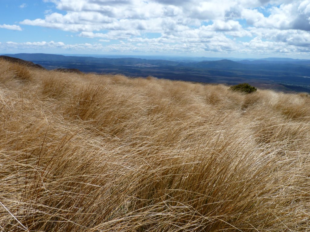
Non-native tussock transitions into forest at the end of the trail.
We had anticipated this crossing since we first started planning this trip, and our tired muscles were the souvenir from our day among the craters.

.

Tuesday, November 2, 2010

Wai-O-Tapu Thermal Area, NZ: Not Quite Yellowstone, But...

It was a chilly morning when we left our thermal sanctuary for a day trip to the nearby self-proclaimed "Wai-O-Tapu Thermal Wonderland".  It was a short 9 km bike ride away, and we had a 10:15 appointment.  Lady Knox Geyser shows her stuff once a day at that time.

The cold morning air made evident the steamy spots on the ridges in the vicinity.
Lady Knox warming up for her performance.
It is a bit convenient that she erupts at about that time -- ideal for tour buses arriving from Rotorura and wayward cyclists from across the valley.  And just before that time, a Department of Conservation ranger saunters up beside her and tells this story.  Over a hundred years ago, there was no mound here, there was no geyser.  There was just a hot pool that one day some prisoners from a nearby camp used to wash their clothes.  And the next thing they knew they were knocked over by a jet of steam.  Apparently the surfactant action of the soap broke the surface tension between two underground chambers of super hot water and caused the geyser to erupt.  A tourist attraction is born.

Lady Knox begins to froth following some human intervention.
And so now each day at about 10:10 am the ranger deposits 300 grams of soap down the Lady's throat, and an eruption, lasting almost an hour, happens to the delight of a paying audience.

Showtime!!!

After the initial blast the crowd begins to wane, and there is an opportunity to have your picture taken with the Lady.
So we joined the crowd and went down the road a bit to view the rest of this area's thermal wonders, naturally occuring, of course.

Craters formed when acid vapors dissolve the soil above the hot groundwater.

The Champagne Pool

Hot water bubbles breaking the surface of another pool.

A Pied Stilt, apparently able to tolerate the hot, acidic waters.

Frying Pan Flat

The bright hue of the edge of The Champagne Pool

The variety of the pool colors are due to varying mineral content.  This is the Devil's Bath, where excess water from the Champagne Pool mixes with sulfur and ferrous salts.

Just outside the Wonderland is a free feature, the Mud Pools.  Absolutely delightful.


.

Monday, November 1, 2010

Waikite Valley, NZ: Passive Bathing

We were just looking for a inexpensive campground on our way to the next thermal tourist venue. We arrived early since it was a short 30 km south of Rotorua. And what we found was a hot pool wonderland.  By early afternoon we were soaking those bike saddle sores away.

John experiencing the "Living Waters"
Owned by the local district government, Waikite Valley Thermal Pools is an oasis.  Multiple constructed pools are within steps of our campsite along a steaming creek.  A couple were of standard swimming pool design, but the rest were concrete tubs of various shapes and sizes nestled among tropical plants and surrounded by the green pasture lands.

Water temperature is checked each hour to maintain the optimal bathing environment.
The pools are drained each night at 8:30pm, and then gradually refilled with fresh water overnight.  We were settling in for the night when we heard the rushing of water as they opened the valves and the flood filled the creek adjacent to our tent.  The monitoring of tub temperature does not start until 9am the next morning, but campers are allowed to enter before then -- they are warned that the water might be hot, and not immerse the head.  But that was the limit of warning -- perhaps the Kiwis understand the concept of personal responsibility a bit better and leave the pools open instead of fearing litigation.


Hot water is conveyed down a series of cascades to cool it before it fills the pools and tubs.

A trail leads uphill from the pools to the source of the hot water.

Te Manaroa Spring, where the waters are perpetually boiling.

Another miracle of water bubbling from the ground.

.

Translate

Copyright

All original text and photos are copyrighted Doris Reilly © 2006-2023. No part of the content or the blog may be reproduced without prior written permission.
Powered by Blogger.

Contact Form

Name

Email *

Message *