We climbed over volcanoes today. Just us, and a few hundred other trampers we didn't know. We completed the
Tongariro Alpine Crossing, an 18.5 kilometer hike that is considered on of New Zealand's best one-day tramps. Apparently we weren't the only ones who heard about it.
 |
| Long sections of the trail had constructed boardwalks and stairs. |
It is the type of hike that attracts experienced hikers (with daypacks, sturdy shoes, rain gear) with those who may have never hiked (like the Asian woman I saw with tennis shoes that carried a purse on her shoulder the whole way). But the opportunity to pass through a landscape formed by active volcanoes with such a variety of stunning features appeals not just to geology-geeks like ourselves.
 |
| Looking northwest from the edge of the first crater. |
It is a one-way hike, so there are numerous shuttle companies that will pick up from where you are staying, drop you off at the trailhead, and pick you up again at the end, all for about $35. It was a bit of a mad rush at the beginning as the hikers try to jostle for position on the boardwalks and stairs. But varying degrees of fitness and photo collecting tended to spread the crowd out. We dawdled in places and stopped for a long lunch break and were at the end by 3:30pm, while others pushed on and finished by 1:30pm, only to sit and wait for the shuttle that would not arrive until 4:00pm.
 |
| The flat crater floor is like a moonscape. |
We had hoped for a clear day, and the sun was out when we started, but the clouds built quickly and covered the peak tops by late morning. So this photo album is a bit subdued. We started in shorts, but it was cold and breezy at the top, where we layered up, only to pull everything off again when we dropped down the other side.
 |
| Steaming ground underfoot. |
 |
| Mount Ngauruhoe, whose screen name is Mount Doom |
 . . |
| Hikers descending from Red Crater (1886 metres), the highest point on the Tongariro Alpine Crossing, into Central Crater. Blue Lake is the puddle on the horizon. |
 |
| Gratuitous shot, but can't beat the view of Emerald Lakes in the background. John's body language seems to indicate that it was a bit chilly. |
 |
| Fire and ice. |
 |
| It is all downhill from here. |
 |
| Mount Ruapehu peeking out around the shoulder of Mount Ngauruhoe |
 |
| Flowers began to appear as we dropped in elevation out of the barren volcanic rock of the craters. |
 |
| Descending down, with views of the reservoir Lake Rotoairo in the near, and Lake Taupo, a crater lake, in the distance. |
 |
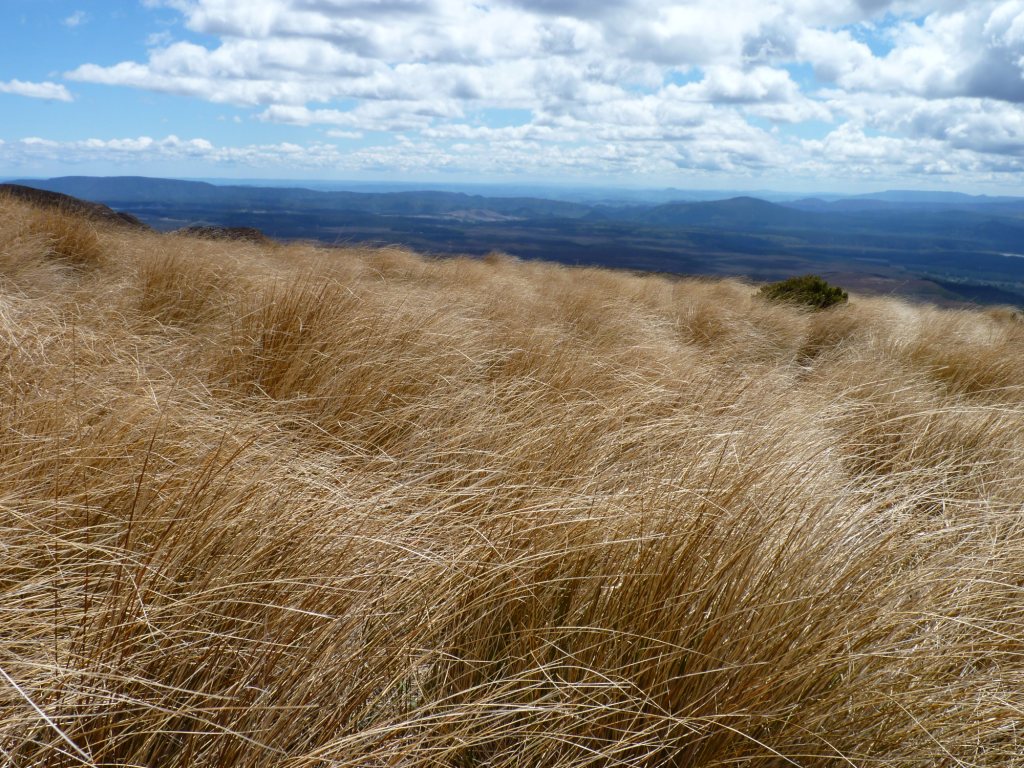
| Non-native tussock transitions into forest at the end of the trail. |
We had anticipated this crossing since we first started planning this trip, and our tired muscles were the souvenir from our day among the craters.
.


0 comments:
Post a Comment