Jarbidge Crossings

 Note: This post includes a link to a video sharing site -- you may need to download the Adobe Flash player to view it. -- DR
If it is solitude, isolation, and landscapes of great beauty you seek, then the Jarbidge Wilderness is the place to go. Much of Nevada is in general sparsely populated and remote, but this area in the northeastern corner of the state is especially so. On the advice of the Forest Service office in Wells, we headed to the Slide Creek trailhead, 20 miles off a dirt road, and even the last of the paved road was a couple hours from any settlement. Our goal was another three day backpack trip to explore the wilderness.
Our first day was one of stream crossings. As with much of the places we have been so far this year in the West, the exceptional snows from the winter stayed late, but were melting fast and swelling the creeks. Most stream crossing have an array of rocks or logs that one can use to get across without taking off the boots. The use of hiking poles offsets the compromised balance from a carrying a full pack in these Twister-like situations. For larger streams, taking off the boots may be necessary but never welcome for a couple of reasons – the water can be icy, toe-numbing cold, and it takes a good 15 to 20 minutes to do the full boot removal, cross, dry feet, boots on sequence. In the past situations that required boot removal, we would cross in bare feet, feeling our way across slippery rocks. I can remember one particular hairy crossing with our friend Gwen in Convict Creek in the Sierra – besides being deep and swift, the crossing was particularly wide, and by the time we got to the other side we were in pain and near tears. We now carry a pair of “Aqua Socks” – beach sandals with a rubber sole and mesh material top. John and I have near the same foot size so we only carry one pair. I sewed a nylon bag for the shoes. Now one of us will cross first while tethered to a 50-foot cord. After crossing the socks go in the bag, tied to the cord, and thrown to the person on the other side.
The loop trip John scoped out followed Slide Creek – we dropped down in elevation for about 6 miles before hitting the East Fork of Jarbidge Creek. The plan was to cross and head up a canyon to Emerald Lake, but when we came to that crossing, we hesitated. We watched the creek for a while – it was flowing fast and was at least three feet deep. A loss of footing could send us bobbing like an apple at a Halloween party. Fortunately we had an alternate route, and we bypassed the crossing and continued up canyon. We encountered only one other significant stream crossing, across two spindly tree trunks tied together with appeared to be kite string which offered a challenge in poise and balance. See John cross a stream from this link.
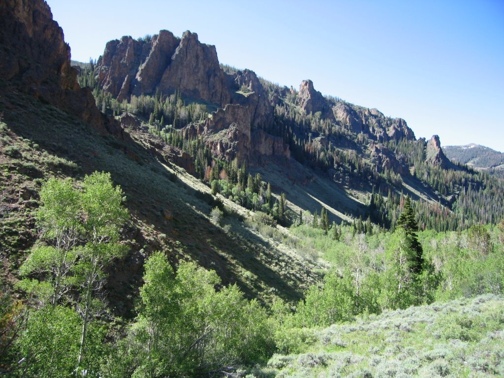
The area is primarily volcanic rocks that form benches and hoodoos. The terrain is steep with prominent avalanche slide paths on the slopes. These are desert mountains, but in the creek bottoms it is lush, with plentiful wildflowers, cottonwoods, skunk cabbage, and grasses. The higher slopes are covered with sagebrush, but from a distance it is a continuous green that offsets the red of the rocks, occasionally punctuated by lingering snow drifts.
As we hiked the trail, we saw evidence of other hikers – an occasional candy wrapper, some flattened vegetation, boot prints in the mud. As we neared our final stream crossing before camp, gathered at the base of a tree was a crowd – 17 Boy Sprouts and three of their leaders. They were as surprised to see us as we were to see them. They hailed from Twin Falls, Idaho and ranged in age from 12 to 18 years old. Out for three days, they had one more night before heading home. One leader commented he was ready for a hamburger. We enjoyed chatting with them, but were relieved to hear they were hiking a few more miles before setting up camp – the feeling of solitude is a bit dampened by that many pubescent boys so close by.
The next day was one of great scenery but physical challenge. Already tired from the previous day, our loop took us another 1,600 feet up in elevation to a point where the trail was obscured by snow. An inconvenient place, since we had to cross over a ridge that was nearly vertical in places. We ended up going cross-country up to a saddle that looked like where the trail should terminate – with John’s superior navigation skills, it was the right place. The rest of the day was mostly uphill. When we finally came to a high point with a panoramic view of the valleys to the east, we made camp. I was beat – we set up the tent and washed up. I could not resist lying down on the lofted down bags, with the afternoon breeze wafting through the tent and, taking a nap – I felt like an angel bedded in a cloud. (The second picture is from this campsite -- if you look real close you can see me in the picture.)
We completed our loop the next day, going mostly horizontal on a very infrequently traveled stretch. The trail was almost indiscernible in places, overgrown with brush and with many trees blown down across the trail. Funding for maintenance activities in these remote areas have not been available for decades, and probably won’t be in the future, so our laying of treads helped keep them from disappearing in some small way.
1 comments:
I remember that crossing well!
Gwen
Post a Comment